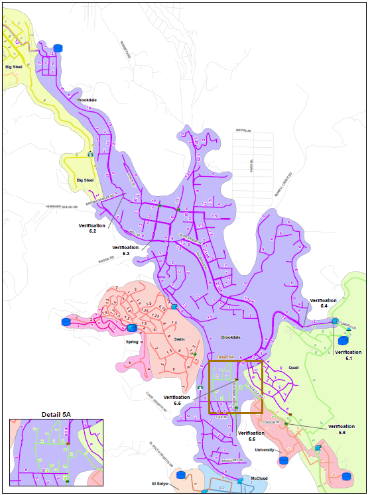
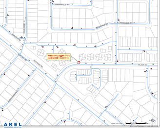
GIS has become an integral part of water and wastewater assets’ capacity and condition evaluations, and planning. In fact, the hydraulic models Akel Engineering Group use are fully compatible with the latest versions of ESRI’s Advanced ArcGIS Pro Environment.
Akel Engineering Group implements a sustainable approach to the development of water or wastewater facility GIS, tracking the existing data sources, and identifying their level of integrity, and documenting in a GIS Data Gap Analysis.
Our methodology establishes a more systematic and sustainable process for the development and for future updates of water/wastewater facilities, and based on budget availabilities.